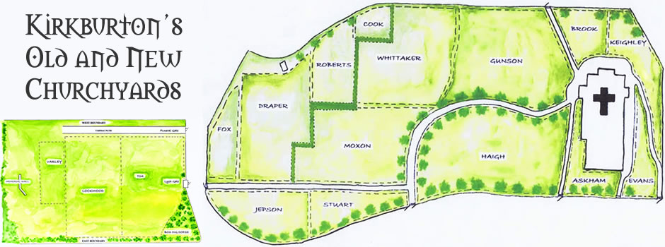
The Church of England have embarked on an ambitious plan to map all of their burial grounds and churchyards using the latest laser scanning techniques. The All Hallows’ Churchyard in Kirkburton was lucky enough to be chosen as a pilot for this exciting new technology. A company called Atlantic Geomatics, who are experts in geospatial mapping, were able to map and record our chuch grounds. Please see the link below to visit the web site at https://kirkburton.burialgrounds.co.uk/


John Wakley’s Inscription Records
The graveyard around the All Hallows Church, in Kirkburton, has more than 2000 graves with over 5000 inscriptions. As a volunteer in the award-winning Kirkburton Churchyard Team, John Wakley would regularly be tidying the grounds and noticed that people interested in tracing their family relatives often had troubles because the exact location of the grave they were looking for was unknown, or sometimes the inscriptions had become illegible over time. To preserve this historic record, and to make the searching a lot easier, Mr Wakley recorded the inscriptions, plotted each gravestone on his hand-drawn maps, and made the records available to the wider community. We remember his efforts in the Churchyard by having the main path through the churchyard named Wakley Way in his memory in 2019.
Instructions
- Enter a value in the search box below each column to restrict the table to display rows with that value in the specified column e.g. Entering ‘car‘ in the surname search box will filter the display to show Carter, Cartwright etc.
- To search across the whole table use the Search box at the top
- The search is not case-sensitive and you don’t need the quotation marks.
- By clicking on the column headers you can arrange the data into ascending or descending order.


